Google As Terror Tool?
JFK terror plotter directed cohorts to use satellite mapping service

View Document
Google As Terror Tool?
-
 Google As Terror Tool?
 -
 Google As Terror Tool?
 -
 Google As Terror Tool?
 -
 Google As Terror Tool?
 -
 Google As Terror Tool?
 -
 Google As Terror Tool?


JUNE 4--One of the plotters behind the alleged scheme to explode gas pipelines at John F. Kennedy International Airport directed his co-conspirators to use Google Earth to obtain detailed aerial photos of the targeted facility.
In a federal criminal complaint, an excerpt from which you'll find here, one of the accused, Abdul Kadir, reportedly told cohorts to use the popular satellite software after he determined that surveillance video shot by the men was "not sufficiently detailed for operational purposes."
Kadir, a Guyanese citizen and former member of that country's parliament, made the Google suggestion during a February meeting with an alleged co-conspirator and a government informant. Kadir and three other men have been charged with planning the terror attack.
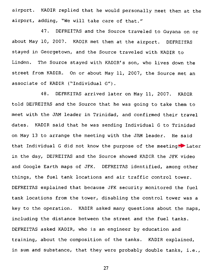
According to the complaint, the snitch followed through and obtained the Google aerial images of JFK, which the men code named the "chicken farm." At a May 11 meeting in Guyana, Kadir was shown the surveillance video and the Google Earth maps of JFK by the informant and Russell Defreitas, one of those charged in the airport attack plan.
Defreitas, the complaint notes, "identified, among other things, the fuel tank locations and air traffic control tower." For his part, Kadir "asked many questions about the maps, including the distance between the street and the fuel tanks." (6 pages)
Featured
